
We’ve introduced RocketNews24 readers to Shiraishi Island and Manabe Island in the Seto Inland Sea before, but today, we’re going to take you on a tour of a sister island in the same group. Sandwiched between Shiraishijima and Manabeshima in Okayama Prefecture’s Kasaoka Island Chain is an island called Kitagishima. It’s the largest island of the group (20km around) and you need transportation to get to the sites. There is no bus service, so if you don’t have your own car or motorcycle, you really can’t see much of Kitagi. Unless, of course, you have a bicycle! Kitagi has it’s own bike path, making it perfect for a two-wheeled day-trip.
Join our bicycling reporter as she takes you on a ride, making all your dreams come true on Kitagi, an island of private beaches, home-made pizza, cute goats, a huge granite vagina (optional). At the end of the article is an original, downloadable English map. Now that’s covering ALL the bases, isn’t it? Okay, let’s go!
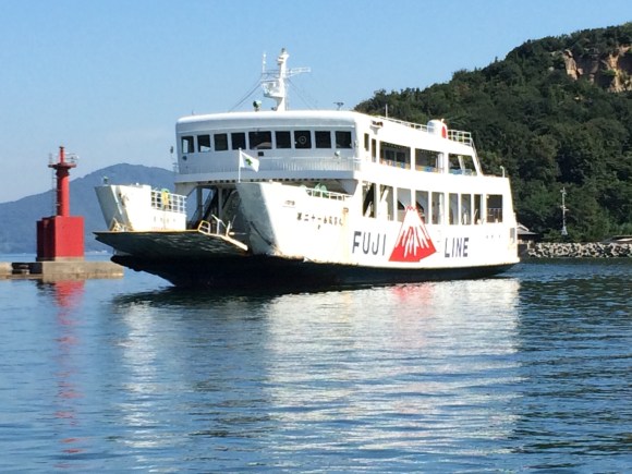
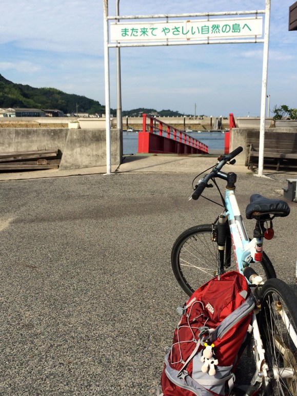
Ferries for Kitagi leave from Okayama Prefecture’s Kasaoka Port and Fushigoe Ports located in Kasaoka City behind the Kasaoka JR train station. But since I was coming from the neighboring island, Shiraishi, I hopped on the Kaneburo Maru ferry that drops one off at Kanaburo Port on the northwest part of Kitagi. From there, I started my bicycle journey clockwise around the island.
Kitagi has several ports. From Kaneburo, I passed Chinohama, Kusunoki, and O-ura ports, all with ferry lines going to them. It doesn’t really matter which ferry you take since you can ride around the island and be back at the same port within a few hours.
But for all the ports and ferries coming back and forth, surprisingly, there are only about 980 people living on the island. This is in contrast to the old days when thousands of people lived here and stone mining factories were the mainstay of economic life. So popular was Kitagi granite rock, that it was used to build parts of Osaka Castle, Fukuyama Castle, Meiji Shrine (Tokyo), and the torii gate at Yasukuni Shrine (Tokyo).
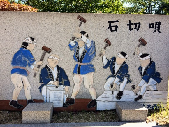
Rock mining brought great wealth to the island; the island’s rock mining song even includes the line, “To the left, to the right, money everywhere.”
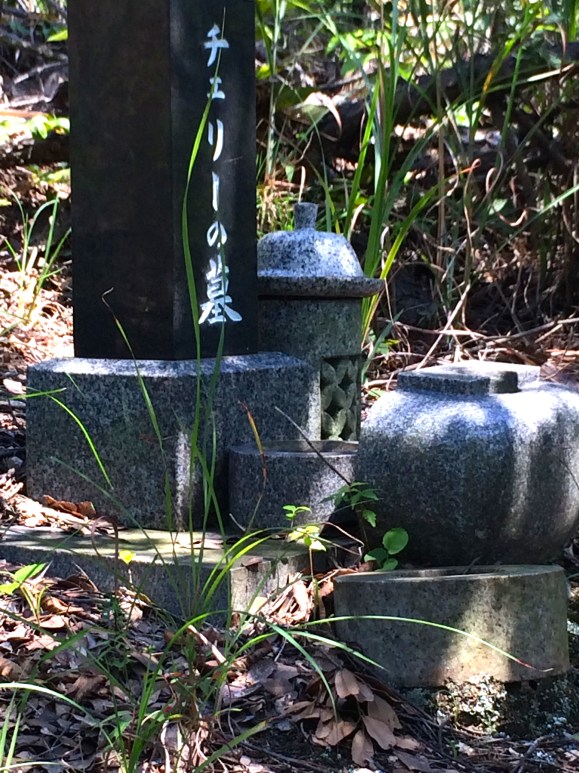
▼A lavish memorial for a pet named “Cherry” attests to the wealth of the people living here.
But all the dust and noise of the stone mining factories is history now, and Kitagi has returned to its natural roots. This is most evident by bicycle, as one passes through numerous quiet coves,
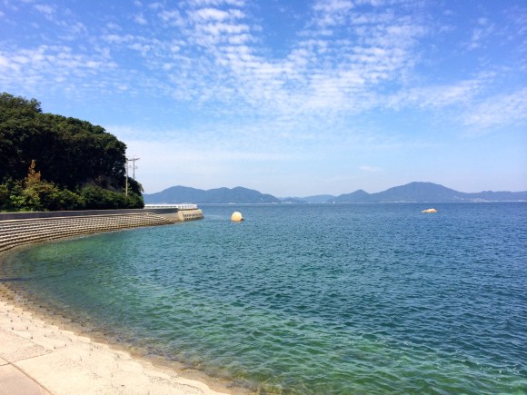 with clear water.
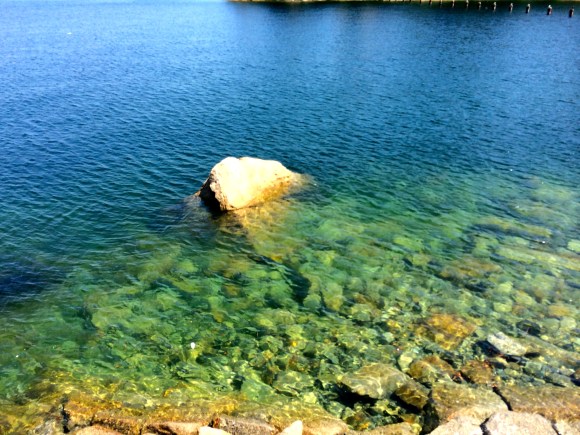
▼Kusunoki Port 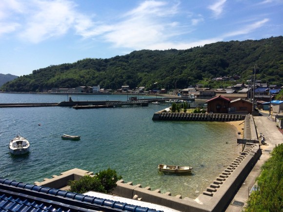
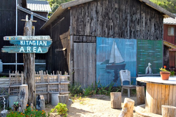
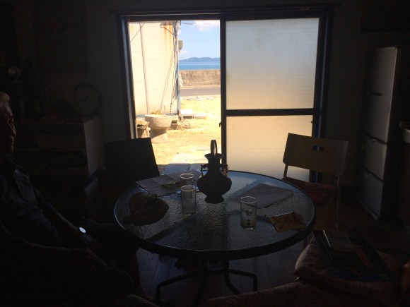
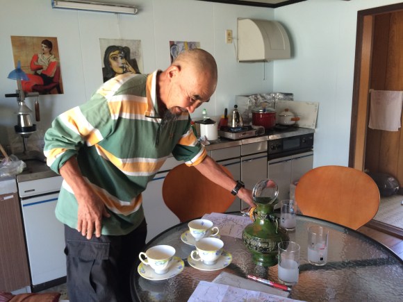
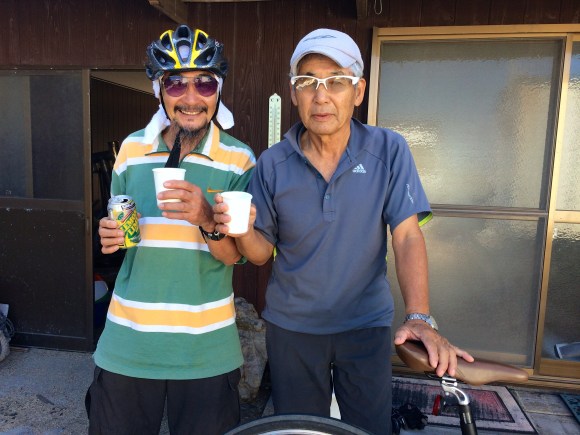
▼At O-ura, I stopped in to see my friend Nakamura-san. He has set up a rest stop in front of his house especially for bicyclers (#11 on map).
“Even though I have a sign that says Welcome to Kitagian area, bicyclers never stop here,” Nakamura-san lamented.
▼Nakamura-san invited me in and served coffee.
“What’s a Kitagian?” I asked him. “One who lives on Kitagi!” he exclaimed. “You know, like someone who lives in Chicago is a Chicagoan, or like you–you’re an Ohioan.”
I told him that I was sure that if people understood what a Kitagian was, they’d stop. “Please tell them,” he said. So I’m telling you now.
▼Nakamura-san has a fine view of the Seto Inland Sea from his house.
Nakamura-san hopes people will feel free to take a rest in front of his house while bicycling around the island. “And tell them that if they can see that I am home, to please knock on my door.”
Nakamura-san has offered to show us around Kitagi today. He’s even going to take us to see the Vagina Rock.
▼Nakamura-san

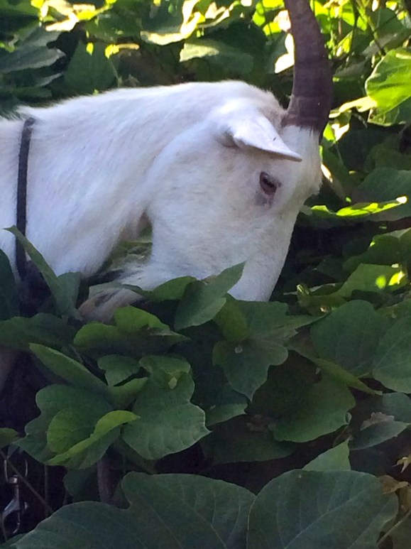
Continuing south from O-ura, we enter a part of the island that is less populated and mostly forest. Oh, what’s that in the distance?
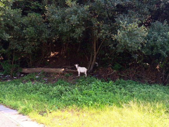
▼A goat! How cool is that?
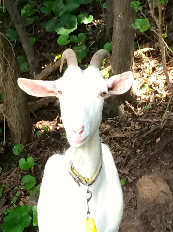
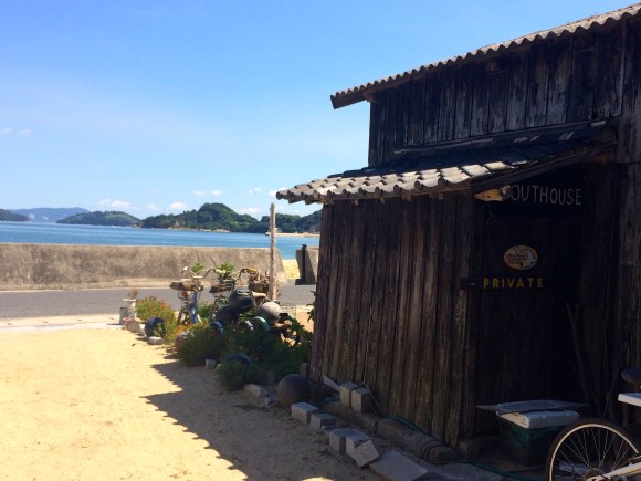
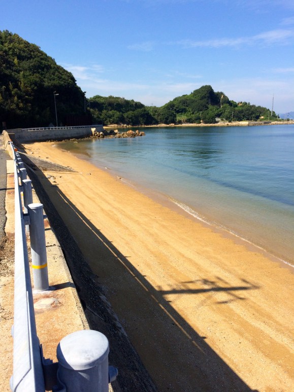
After a chat with the goat, we come to a very nice, private beach.
▼Sotoazami Beach
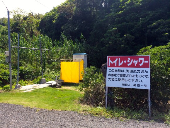
Across the street from the beach is a public toilet and shower. According to the sign, a kind resident has set up these facilities for beach-goers.
▼Facilities available only in July and August (#17 on map)
Just to the left of the public toilet and showers, there’s a walking path. This path goes up into the mountain. The first house on our left is “Shima no Sarai,” (#18 on map) where our friend Mr. Yamamoto lives. We call him Kuni-san.
Kuni-san is getting ready for a live concert he’s hosting in his house this weekend. I had seen flyers posted around the island, so I knew he was hosting something special. Since he is busy preparing though, we’ll only stay a little while.
▼Kuni-san, making pizzas which he bakes in his hand-made brick oven outside.
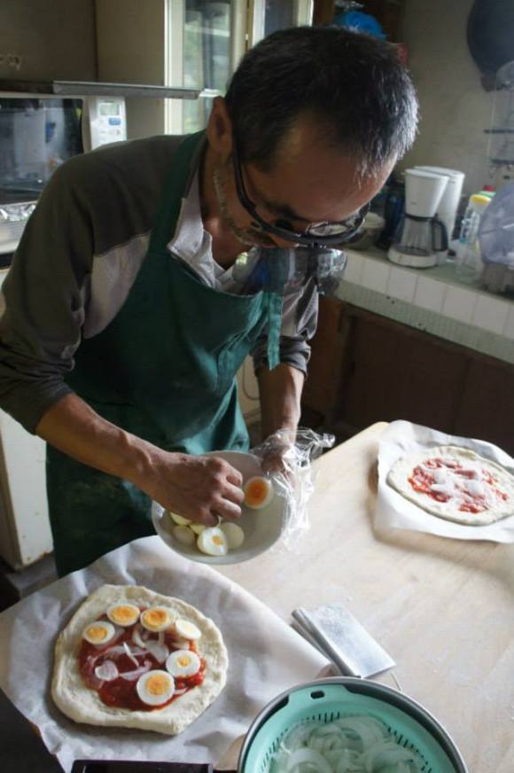 Photo: Yamamoto Kunihiko
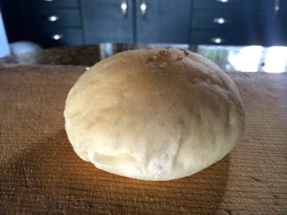
▼I sampled some of his bread, baked in the same brick oven. Now that’s one piece of fresh goodness!
▼Kuni-san also serves goat milk and goat cheese, produced in cooperation with his four goatly friends.
▼This is Suzuran-chan. Isn’t she cute? I bet her cheese is too.

Besides pretty goats, Kuni’s got a cute dog too.
▼Masamune-chan, enjoying the good island life.
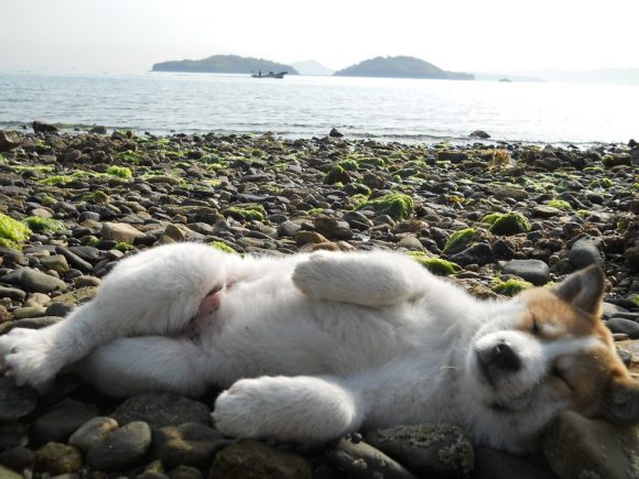 Photo: Yamamoto Kunihiko
When Kuni-san hosts live concerts, he also holds a BBQ on Sotoazami Beach.
▼The moonrise from Satoazami Beach.
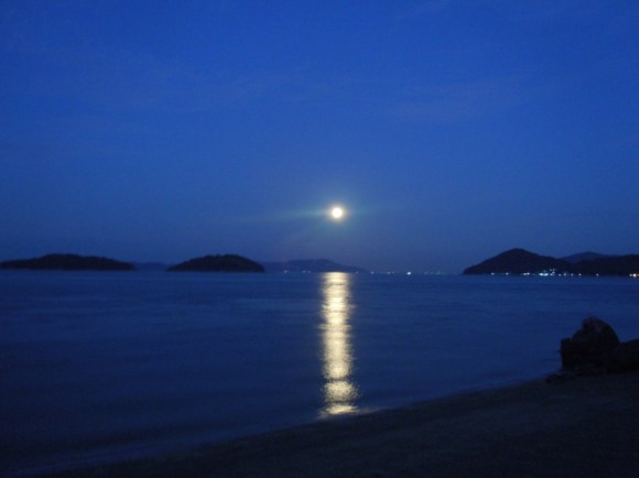 Photo: Yamamoto Kunihiko
▼Masamune-chan watched the moonrise too.
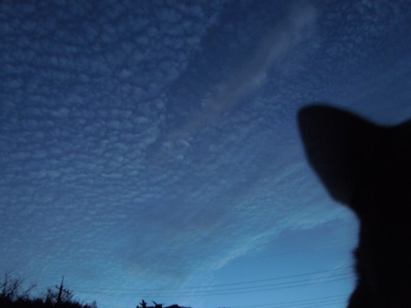 Photo: Yamamoto Kunihiko
It’s a shame we will miss Kuni’s concert this time, but he’s hosting a jazz concert on Nov. 8. Let’s try to make that one!
After visiting with Kuni-san, eating his bread and petting his goats, it’s time to continue around the island.
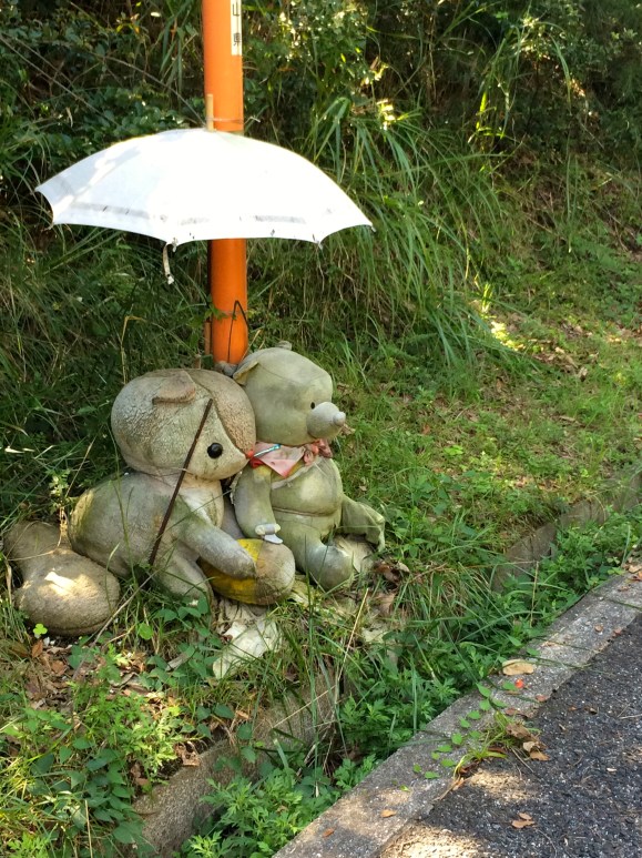
▼We pass some friendly-looking stuffed animals hanging out along the road.
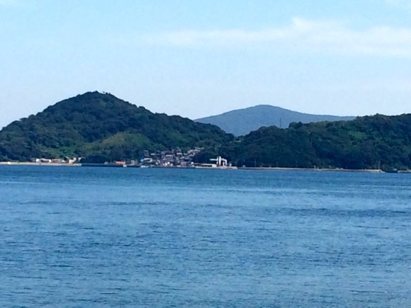
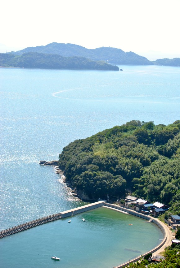
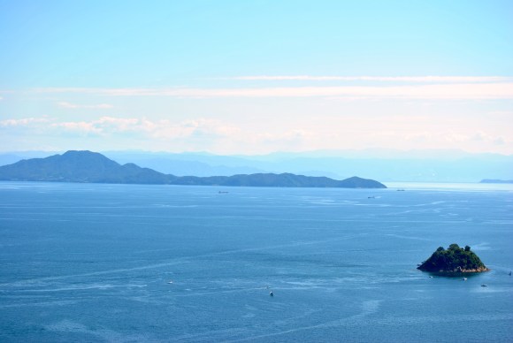
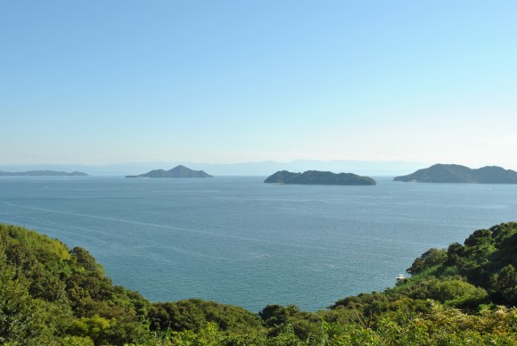
▼Now at the south-east tip of the island, we can see across to Manabe Island.
We finally hit the end of the vehicular road at Maru-iwa Port. If we were in a car, we’d have to end our trip here. But since we have bicycles, we can take the bike path that follows the west side of the island where the most awesome sea views are.
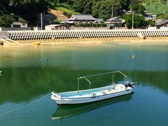
▼ Maru-iwa, a small port used by fishermen.
Maru-iwa Port is also the point where a hiking trail leads up Hachimanzan mountain to Vagina Rock.
First, let’s head to Vagina Rock! (You were hoping I’d say that, weren’t you?). We’ll leave our bicycles on the road.
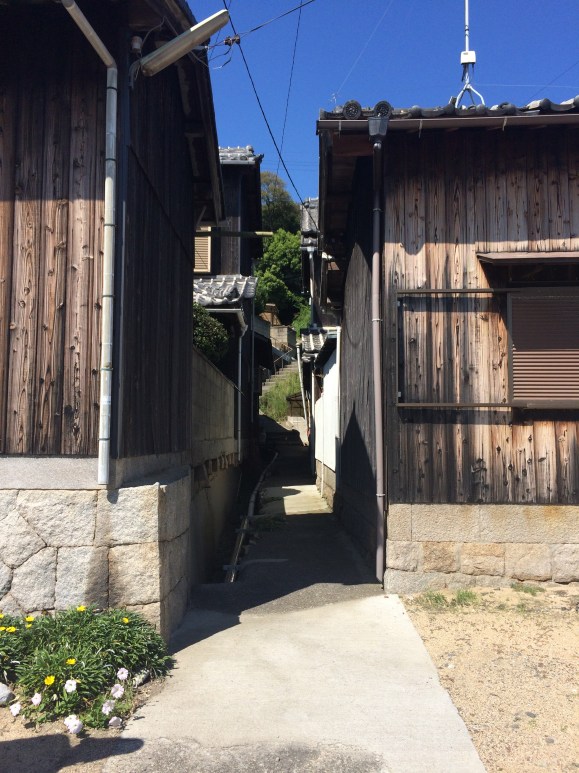
▼The entrance to the trail is between two houses and looks like this:
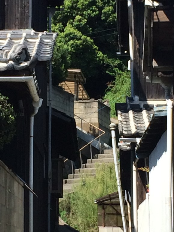
▼Notice the stairs in the distance.
▼Yep, those stairs! Follow them up.
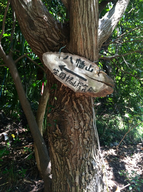
There are no signs to Vagina Rock, so keep your eyes peeled. We’ll follow signs (where there are any) to Hachimanzan.
▼Sign to Hachimanzan
A couple of minutes into the hike, the road will dead-end. Take a right and follow along the house.
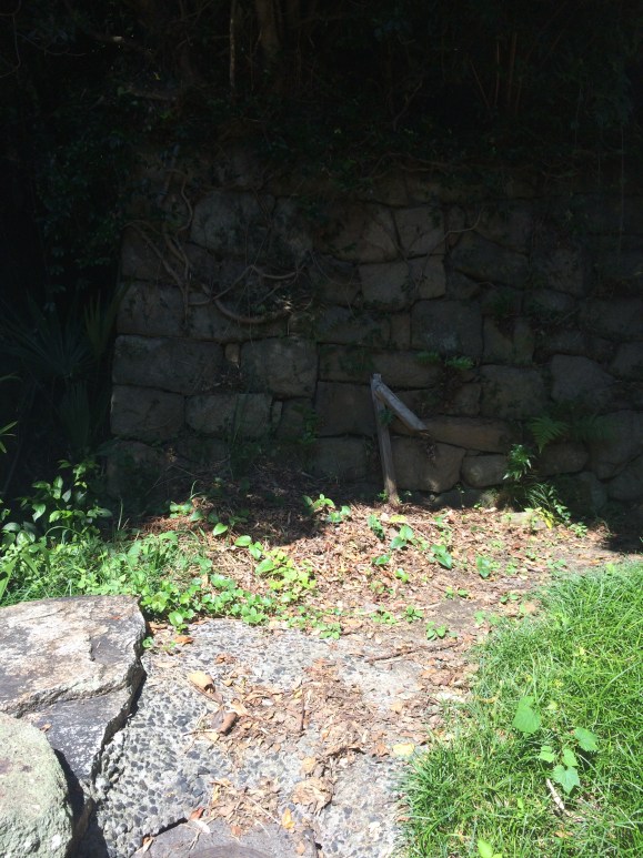
At the six stone Jizo statues, take a left.
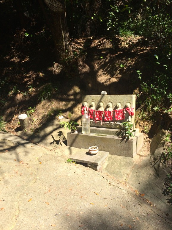
Pass through the shrine.
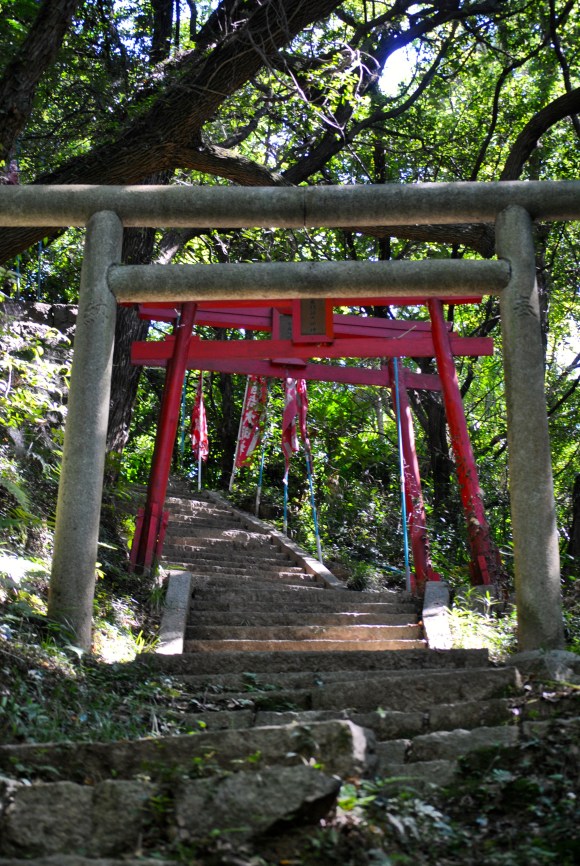
By now, we’re able to see down to Maru-iwa Port, where we started our hike.
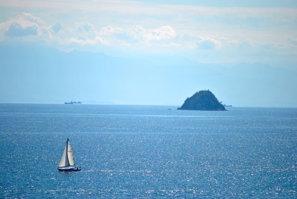
Once we’ve passed the shrine, we start seeing big rocks.

Although these are not vaginal rocks, they offer great views of the Seto Inland Sea.
Keep following the rocks and looking at the views. You’re getting closer to that female anatomy!
Okay, we’ve finally arrived at that alluring rock.
▼This, my friends, is the scenery from the top of Vagina Rock. What a view!

▼And this is the top of Vagina Rock.

But to see the vagina properly, you have to look up from the bottom of the rock. This is a little tricky, so we have to beat our way down through the brush to the bottom. Now, look up.
▼Oh, but it’s too much–I can’t show you!
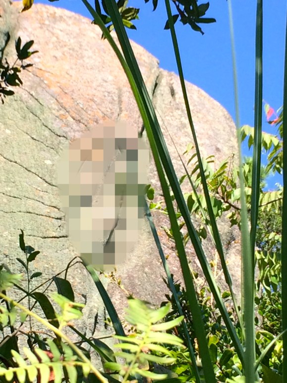
You really want to see it? Are you suuuuure? You’re over 18, right? Okay.
▼Ohhhhh, wowwwww!

Apparently, Vagina Rock is at her best when water is rushing down the mountain and through the crevice. But I’ll leave that to your imagination.
Now, with a feeling of tingling joy and satisfaction, and perhaps after having a cigarette, we walk back down to the main road. We grab our bicycles and head to the bicycle path.
Take a right up the road that goes between some houses. On your left is the entrance to the bicycle path (#19 on the map).
Ride along the path until you get to this fork. Take the low road.
▼This road goes to Kaneburo 金風呂, and is sign-posted.

▼The bicycle path is paved the entire way.

And has spectacular scenery.

When you get to this sign, leave your bicycle at the top and walk down the path to Shimo-ura.

Here you’ll find a beautiful private beach!

▼ All yours!

In the summertime, a local islander sets up an umi-no-ie stand to sell beers and some food.
▼This beach is accessible only to those with a boat or bicycle.

▼Ok, back to the bike path!

The path is mostly forested and is about 10 km long.
▼We stop for a rest with another cycler.

Back on our bicycles, the path soon led back into town at Kaneburo.We stopped for an ice cream at the local store before parting ways. I thanked Nakamura-san and got ready to board the ferry back to Shiraishi Island.
Now it’s your turn to take the lead and show your friends Kitagi Island! Don’t forget to download our Kitagi Map–you won’t find a better, more detailed map for this little gem of an island anywhere else.
▼A shout out to these two Kitagians for helping me with this article.
Photos: Amy Chavez/RocketNews24 unless otherwise noted.
 Creepy creatures from the seabed that you can eat!【Taste Test】
 Japan’s secret garbage problem–and what you can do to help
 Shiraishi Island needs YOUR character ideas!
 Osaka to Fukuoka for less than 40 bucks? It’s possible with Japan’s overnight ferry
 Vegetables are smarter than fruits: Three high IQ Japanese veggies
 McDonald’s new Happy Meals offer up cute and practical Sanrio lifestyle goods
 Studio Ghibli releases new action figures featuring Nausicaä of the Valley of the Wind characters
 Katsudon vs. tonkatsu vs. katsu sandwich – What’s the best way to eat pork cutlet in Japan?
 Studio Ghibli glasses cases let anime characters keep an eye on your spectacles
 Super Nintendo World expansion gets delayed for several months at Universal Studios Japan
 All-you-can-drink Starbucks and amazing views part of Tokyo’s new 170 meter-high sky lounge
 Kyoto’s 100 Demons yokai monster parade returns!
 Arrest proves a common Japanese saying about apologies and police
 Japan has a bondage bunny character with its own line of kinky cute merchandise
 Pizza Hut’s new coriander pizza contains more cilantro than ever before!
 More foreign tourists than ever before in history visited Japan last month
 Disney princesses get official manga makeovers for Manga Princess Cafe opening in Tokyo
 Starbucks reopens at Shibuya Scramble Crossing with new look and design concept
 Beautiful new Final Fantasy T-shirt collection on the way from Uniqlo【Photos】
 Is the new Shinkansen Train Desk ticket worth it?
 Foreign English teachers in Japan pick their favorite Japanese-language phrases【Survey】
 Beautiful Sailor Moon manhole cover coasters being given out for free by Tokyo tourist center
 Studio Ghibli releases Kiki’s Delivery Service chocolate cake pouches in Japan
 Japan’s bone-breaking and record-breaking roller coaster is permanently shutting down
 New definition of “Japanese whiskey” goes into effect to prevent fakes from fooling overseas buyers
 Our Japanese reporter visits Costco in the U.S., finds super American and very Japanese things
 Studio Ghibli unveils Mother’s Day gift set that captures the love in My Neighbour Totoro
 Domino’s Japan now sells…pizza ears?
 New Japanese KitKat flavour stars Sanrio characters, including Hello Kitty
 One of Tokyo’s most famous meeting-spot landmarks is closing for good
 Kyoto creates new for-tourist buses to address overtourism with higher prices, faster rides
 Sales of Japan’s most convenient train ticket/shopping payment cards suspended indefinitely
 Sold-out Studio Ghibli desktop humidifiers are back so Totoro can help you through the dry season
 Japanese government to make first change to romanization spelling rules since the 1950s
 Ghibli founders Toshio Suzuki and Hayao Miyazaki contribute to Japanese whisky Totoro label design
 Doraemon found buried at sea as scene from 1993 anime becomes real life【Photos】
 Tokyo’s most famous Starbucks is closed
 One Piece characters’ nationalities revealed, but fans have mixed opinions
 We asked a Uniqlo employee what four things we should buy and their suggestions didn’t disappoint
 Princesses, fruits, and blacksmiths: Study reveals the 30 most unusual family names in Japan
 The top 5 places to see the sun set in Japan
 Ed Sheeran invited to visit cat island in Japan with video from Japanese town
 This private island in the Pacific Ocean is open to guests – but only Japanese ones
 The only path to this Nagasaki Shinto shrine gets swallowed by the sea every day【Video】
 Bizarre bicycle vandalism reported to mayor of Komono Town, mayor admits to it
 Walking Bicycle Club looks to change the way we ride, angers internet with promotional video
 This remote island guest house may have converted our “private rooms only” traveling reporter
 Want your own private island? We visited one for sale off the coast of Japan【Pics & Video】
 Everything you need to know about takoyaki (octopus balls) 【Video】
 Japanese man rides 1,000 kilometres on stolen mamachari bicycle to see Tokyo for first time
 Drive your car on an airport runway at this secret spot in Japan
 Love Ghibli’s Castle in the Sky? Check out these real Laputa-like locations!
 Reserve your own spot on an uninhabited Japanese island for an unforgettable camping experience
 Take it from a local: This resort island off the coast of Nagasaki is totally worth a side trip
 Check out this absolutely stunning drone video of Nagasaki’s Battleship Island in Ultra HD
 Three bridges in Okinawa Prefecture offer the most spectacular panoramic vistas of the sea【Pics】
 Here’s a handy Japan cycling hack: pump up your tires for free at any police box
Leave a Reply