
While the average human has not yet come unstuck in time, it doesn’t mean we’re completely at a loss when it comes to time travel. Yes, we may only move in a singular direction, but at least have artifacts from the past to help us look back! Everything from old photos to old pottery help us dig through our murky cultural memory to see how things used to be.
And, thanks to Zenrin, a Japanese mapping company based in Oita Prefecture, now you can travel internationally with their collection of digital maps from the Edo and Meiji periods. Whether you think England is a conspiracy of cartographers or you know the name of every mapmaker since Babylonia, there’s something here for everyone!
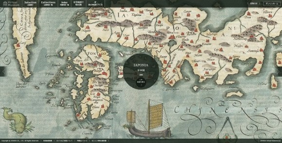
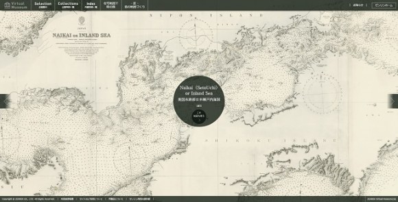
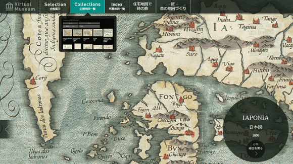
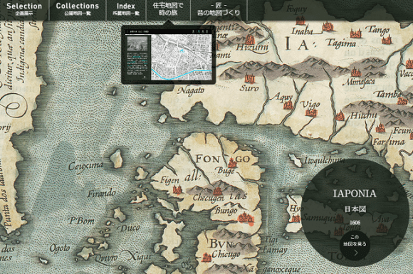
Putting their decades of experience in the map-making business to good use, Zenrin’s Virtual Museum features both domestic and international maps, including one of Paris, though the primary focus is on Japan. Like the map pictured above, which was produced in 1606 by Gerhard Mercator and Jodocus Hondius, the charts span a period of nearly 450 years. Below is a map of the Seto Inland Sea, produced in 1872.
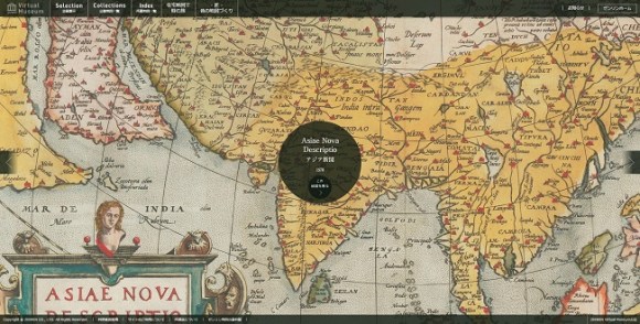
You can also find representations of Asia, like this colorful map from 1570. The way we represented the world certainly looked a lot different 444 years ago!
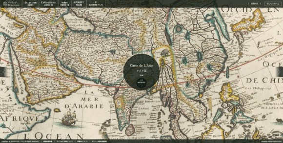
Here’s a slightly newer map of Asia from 1640, produced by Michel Van Locho. If you zoom in and look carefully around the map, you can even spot a few sea monsters!
This mess of lines is actually a map of Paris that apparently traces its growth from old castle walls to the end of the 18th century.

The website boasts around a hundred maps from various times, with a large cache of maps produced between 1927 and 1945 related to the Second World War. Unfortunately, the website is mostly in Japanese, so it could be a bit difficult to navigate. If you want to explore the full range maps they offer, it might take some exploration on your part, but here’s a brief guide to help you get started!
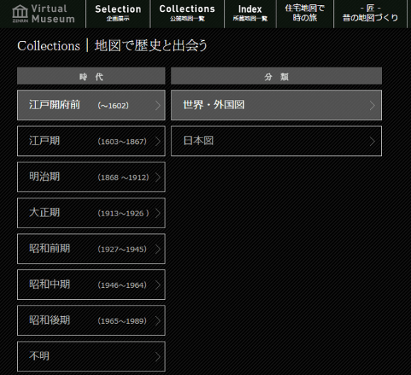
First, the historical maps are primarily under “Collections,” so just click that at the top of the page.
This is the page that you’ll be taken to. Click the time period you want and then select from the subdivisions that appear on the right. “世界・外国図” (the top-right column) is “World and Foreign maps” and “日本図” is Japanese maps. Each time period has different subdivisions, including “道中図、旅行案内図、観光案内図” (“Road, travel guide, and sightseeing guide maps).
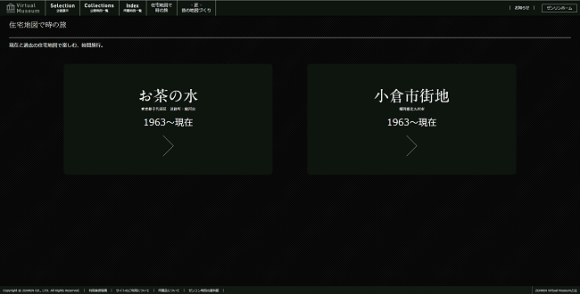
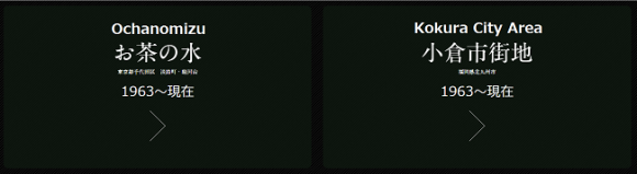
Zenrin also has maps showing the changes in residential areas of Ochanomizu and Kokura City Area from 1963 to present day. First, click the button that reads “住宅地図の時の旅” (“Time travel with residential maps) at the top of the screen.
▼Like this!
The screen below will be shown, and you can select either Ochanomizu or the Kokura City Area.
▼We’ve added the location names in the picture below.
There’s a whole host of maps for you to explore at the Zenrin Virtual Museum, but our favorites are without question the old ones from the 16th and 17th centuries. They really make you appreciate have GPS on your smartphone!
Sources: ITMedia, Zenrin Virtual Museum
Images: Zenrin Virtual Museum
 Japanese government recommends changing Buddhist temple mark on maps to avoid Nazi connotations
 Hang a Japanese city on your wall with these amazingly detailed 3-D printed maps
 East meets West in the Pacific-centered version of the world map
 New app lets you traverse the streets of modern Tokyo and ancient Edo at the same time
 South Korean design company turns subway maps into beautiful artwork you can hang on your wall
 Foreigner’s request for help in Tokyo makes us sad for the state of society
 Japanese city loses residents’ personal data, which was on paper being transported on a windy day
 Historical figures get manga makeovers from artists of Spy x Family, My Hero Academia and more
 Akihabara pop-up shop sells goods made by Japanese prison inmates
 New private rooms on Tokaido Shinkansen change the way we travel from Tokyo to Kyoto
 Suntory x Super Mario collaboration creates a clever way to transform into Mario【Videos】
 Japan’s massive matcha parfait weighs 6 kilos, contains hidden surprises for anyone who eats it
 Anime girl English teacher Ellen-sensei becomes VTuber/VVTUber and NFT
 One-of-a-kind Osaka-themed Uniqlo Shinsaibashi opens
 Starbucks Japan adds a Motto Frappuccino to the menu for a limited time
 McDonald’s new Happy Meals offer up cute and practical Sanrio lifestyle goods
 Japanese ramen restaurants under pressure from new yen banknotes
 French Fries Bread in Tokyo’s Shibuya becomes a hit on social media
 Studio Ghibli releases new action figures featuring Nausicaä of the Valley of the Wind characters
 Red light district sushi restaurant in Tokyo shows us just how wrong we were about it
 Tokyo Tsukiji fish market site to be redeveloped with 50,000-seat stadium, hotel, shopping center
 All-you-can-drink Starbucks and amazing views part of Tokyo’s new 170 meter-high sky lounge
 Beautiful Ghibli sealing wax kits let you create accessories and elegant letter decorations【Pics】
 Studio Ghibli releases Kiki’s Delivery Service chocolate cake pouches in Japan
 New definition of “Japanese whiskey” goes into effect to prevent fakes from fooling overseas buyers
 Our Japanese reporter visits Costco in the U.S., finds super American and very Japanese things
 Studio Ghibli unveils Mother’s Day gift set that captures the love in My Neighbour Totoro
 More foreign tourists than ever before in history visited Japan last month
 New Pokémon cakes let you eat your way through Pikachu and all the Eevee evolutions
 Sales of Japan’s most convenient train ticket/shopping payment cards suspended indefinitely
 Sold-out Studio Ghibli desktop humidifiers are back so Totoro can help you through the dry season
 Japanese government to make first change to romanization spelling rules since the 1950s
 Ghibli founders Toshio Suzuki and Hayao Miyazaki contribute to Japanese whisky Totoro label design
 Doraemon found buried at sea as scene from 1993 anime becomes real life【Photos】
 Tokyo’s most famous Starbucks is closed
 One Piece characters’ nationalities revealed, but fans have mixed opinions
 We asked a Uniqlo employee what four things we should buy and their suggestions didn’t disappoint
 Princesses, fruits, and blacksmiths: Study reveals the 30 most unusual family names in Japan
 Japanese town’s Cat Street View lets you virtually tour its backstreets, meet feline residents
 Traditional Japanese ceramics given new life in AR, delivered straight to your web browser for free
 The Legend of Zelda’s Link is here to help you navigate Google Maps’ dungeons today!
 New 3D aquarium show to let visitors experience a trip to the deep sea in Enoshima
 Tour alleged yakuza hideouts on Google Maps
 Space agency in Japan has a surprising hidden girl in its visitor maps
 Dr. Pepper fans create online map of Japan cataloging everywhere you can buy the divisive drink
 How safe is Japan? New interactive map reveals reports of crime around the country
 VR and GPS combine for new Japanese castle and historical landmark sightseeing app
 New digital art exhibition in Nagoya promises “a paradise of bugs” in a colorful forest
 Vending machine makes commuters smile at Japanese train station
 Space World Station becomes the most misleading station name in Japan
 San’in, Japan is breathtakingly beautiful especially when captured with a 4K video camera【Video】
 Airbnb listing in Japan reveals travel destination with exclusive use of huge private island
 First look at Universal Studios’ Mario Kart ride, Super Nintendo World’s opening date revealed【Vid】
Leave a Reply